Publicaciones Científicas
Investigación en teledetección, deep learning y análisis geoespacial publicada en revistas internacionales con revisión por pares.
Unsupervised volcanic change detection using deep learning embeddings: Case studies of Nevados de Chillán and Llaima volcanoes, Chile (2017–2023)
Abstract
Satellite embeddings—compact numerical representations derived from deep learning models applied to satellite imagery—offer a new paradigm for environmental monitoring that bypasses traditional spectral index selection. This study demonstrates that 64-dimensional embeddings from a Vision Transformer (ViT) model, accessed through Google Earth Engine's public ImageCollection, can detect and classify volcanic surface changes without supervised training or manual feature engineering.
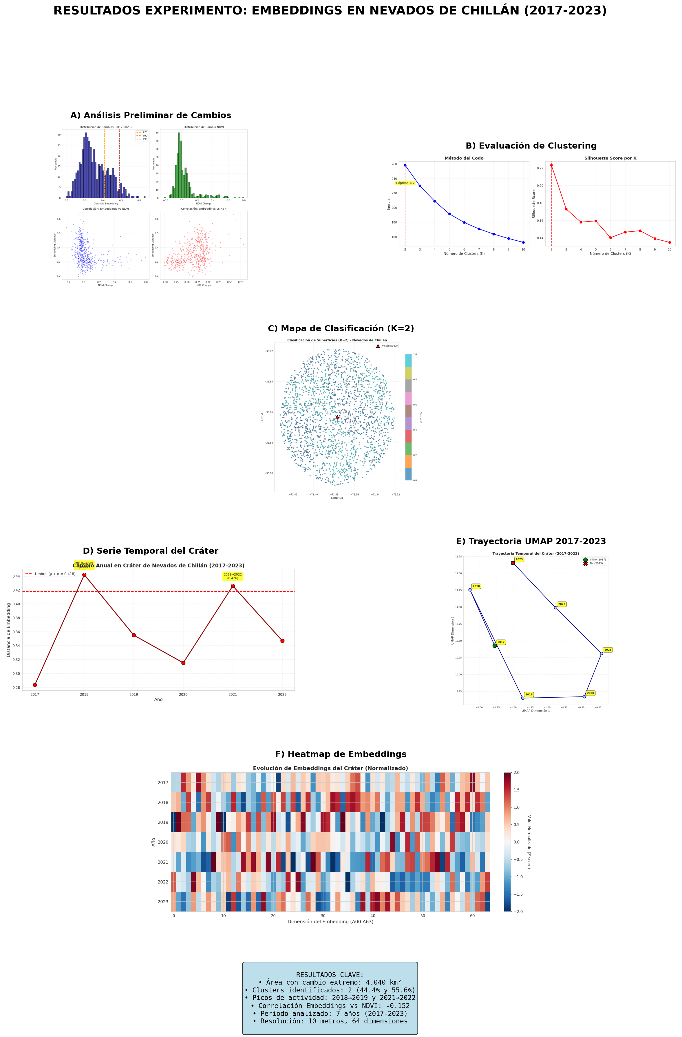
Applied to Nevados de Chillán and Llaima volcanoes in Chile (2017–2023), our unsupervised approach identified distinct surface classes through K-means clustering of embeddings, tracked temporal evolution through embedding distance metrics and UMAP trajectory visualization, and detected both dramatic post-eruption changes and subtle ongoing surface modifications.
At Nevados de Chillán, the method revealed four distinct surface classes and captured the progressive stabilization following the 2016–present eruption cycle. At Llaima, three surface classes were identified with notably smaller temporal changes, consistent with the volcano's current quiescent state. The embedding-based approach achieved high cluster separability (silhouette scores of 0.52–0.59) and produced physically interpretable results consistent with known volcanic activity.
These findings suggest that satellite embeddings could complement traditional remote sensing approaches for operational volcano monitoring, particularly for detecting gradual surface changes that may precede volcanic unrest.
Resultados clave
64-dim
Embeddings ViT
0.52–0.59
Silhouette score
7 años
Período 2017–2023
2 volcanes
Chillán y Llaima
Acceso al artículo
Accepted manuscript. Licensed under CC BY-NC-ND. The published version is available at doi.org/10.1016/j.rsase.2026.101959.
Código fuente
Citar este artículo
Parra, F. (2026). Unsupervised volcanic change detection using deep learning embeddings: Case studies of Nevados de Chillán and Llaima volcanoes, Chile (2017–2023). Remote Sensing Applications: Society and Environment, 101959. https://doi.org/10.1016/j.rsase.2026.101959
Más publicaciones
Otros artículos publicados en revistas internacionales con revisión por pares.
SurtGIS: A High-Performance Raster Geospatial Analysis Library in Rust with WebAssembly and Python Support
Parra, F. · Elsevier, 204, 107102
Motor de análisis raster geoespacial nativo en Rust con 105 algoritmos. 8.2× más rápido que GDAL, 21.7× más rápido que GRASS GIS. Soporte para WebAssembly y Python (PyO3).
Validation of GRACE, ERA5-Land and MODIS remote sensing products for groundwater monitoring in semiarid regions: A multi-basin study in Chile's Coquimbo region
Parra, F.; Rubilar, J. F. · Elsevier, 136157
Evaluación de productos de teledetección satelital para monitoreo de aguas subterráneas en cuencas semiáridas de la región de Coquimbo, Chile.
Modeling and Evaluation of the Susceptibility to Landslide Events Using Machine Learning Algorithms in the Province of Chañaral, Atacama Region, Chile
Parra, F.; González, J.; Chacón, M.; Marín, M. · MDPI, 15(24), 16806
Modelamiento de susceptibilidad a remociones en masa en la Provincia de Chañaral mediante algoritmos de aprendizaje automático, con validación espacial cruzada.
¿Interesado en análisis geoespacial con IA?
Aplicamos técnicas de deep learning y teledetección a problemas reales en agricultura, medioambiente, minería y más.